Showing posts with label Brent Williams. Show all posts

Saturday, March 17, 2012

Computer Science and Information Technology in Malta

On one of the sites we were mapping, we had the pleasure of meeting the head of the Engineering Department from the University of Malta and two students in order to let them view our data collection process. Erik and I got to interview them about our cultural research projects for our ethnic studies class.

My cultural research project is on the role of Computer Science and Information Technology in Malta. The idea of my project came from the startling fact that Malta has very few natural resources. One of the papers I was reading reported that there are "four extractive industries on which manufacturing might be built-- mining,forestry, fishing, and agriculture"[1]. It concluded that Malta has an insufficient environment for any of these industries[1]. Having few local resources for manufacturing severely limits what Malta's economy can do.

This challenged me to think of possible major industries for Malta. I came up with the idea that if the country couldn't base it's economy on making physical products then why can't it make information based products?

Upon talking to the students and the department head, I was informed that unlike Cal Poly, Computer Science is not part of Engineering but is part of their relatively new department of Information and Communication Technology. This didn't affect the quality
of the information that they gave me.

They told me that there is heavy investment in Computer Science and Information Technology. In the latest Business Research and Innovation report from the National Statistics Office of Malta, they reported that 29.47% of all intramural research and development expenditures in 2004 were in computer and
related activities[2].

Also, Maltese government research and development expenditures have increased from €4.1 million to €15.7 million in 2010[3]. Research and development specifically in Engineering and Technology has doubled since 2008 making it the most funded major field of science in Malta. This can be seen in the graph below.


The idea of heavy investment in Computer Science and Information Technology wasn't only reaffirmed by them but was also mentioned by Timmy Gambin who has been helping coordinate our research in Malta. He informed me that the University is constructing a building dedicated to Information and Communication Technology. Upon further research I found that the University was awarded a sum of €17.3 million for the project from the European Regional Development Fund[4]. It was said to be built because of the high demand for Information and Communication Technology graduates[4].

This is some of the information I have come across and I will be reporting on more very soon.

Works Cited

1. Young, B. S. "SocietyThe Maltese Islands: Economic Problems and Prospects for Industrial Development." Geographical Review 53.2 (1963): 263-86. Print.

2. Malta. National Statistics Office. Business Research and Innovation 2004-2006. 2008. Print.

3. Malta. National Statistics Office. Expenditure on Research and Development in the General Government Sector: 2008-2010. 2011. Print.

4. "New ICT Facilities Building at University of Malta." Gozo News. 17 May 2009. Web. 17 Mar. 2012 .

Tuesday, March 6, 2012

Data Visualization: Lighting and Movement

Much has been improved since my last technical update. My whole software has gotten a face lift. First, shading was added. This makes the cistern and glyphs look three dimensional and the visualizations look more aesthetically pleasing. Second, my glyphs are now represented by spheres. This also adds to the aesthetics of the visualization. Thirdly, I generated a fake path of the ROV for a test of my data visualization software using my improved game camera. This new camera allows for easier control of movement through and around the cistern. Next, I recently acquired and implemented some sample temperature data from a past ICEX trip to use in the test of my data visualization software. Also, I interpolated the temperature data and outputted it at equally spaced intervals to show the estimated temperature throughout the cistern based on the readings taken.

Lastly, the decision was made to combine Tyler and my software so that the results of his texture mapping can be shared to increase the visual accuracy of the cisterns. I am currently working on a graphical user interface to allow for ease of control of my program. It shouldn't take too long. More to come soon!

Convento Dei Cappuccini Carini

Phew. Today was full. Zoƫ and I woke up early to go on a run through some back streets in our town just outside of Carini (in the province of Palermo, Sicily). We meandered through all of the tiny little roads in search of an entrance to the enormous mountains situated nearby, but had no luck. Oh well, we have another half a week to try other roads. When we got back the group was up and ready to rock. We joined up, had breakfast, and loaded into the bus.

On the ride over to the first cistern, our Maltese friend Keith told us loads of information about our cultural research projects: namely gun control laws, engineering degrees from University of Malta, Maltese agriculture and horticulture, and some neat facts about the cisterns that we are deploying into. Keith is a graduate student at University of Malta studying archaeology, and is working on his Ph.D. He's a brilliant guy and we're grateful to have him accompanying us.


When we arrived, we hauled all of the equipment out of the van and crossed the street to the site. There was a horse standing around that distracted everyone for a bit before we set all of the equipment up. After getting the generator running and plugging the robot into the control box, we left the gear to take a small tour of the land from our Sicilian archaeologist friend Toto. He showed us some nearby water storage features that might tell us a little bit more about the cistern that we were deploying into. I walked back to the equipment and waited around for the others to do the same. Once we were all there, we booted up and deployed the robot into the well. The water level was too low to drive around or collect SONAR data (our SONAR was acting sporadically at the time anyways), so we just dropped the robot down and recorded video and depth.

We packed everything up, said goodbye to the horse, and got on our way to the next cistern. This one was located in a small city on top of a large mountain behind our hotel. The cistern was situated in a church courtyard, so we headed through the town and into the church to unpack.


At this point, SONAR was still working intermittently, so we deployed the robot, got a single scan that covered the entire simple bell shaped cistern, and drove around to get images for Tim's stereo imaging project. We did a bit of troubleshooting with the SONAR but had no luck. After packing all the gear up, we had some pizza down town, and drove back to the hotel.

When we arrived, our professors told Tyler, Brent, and I to run through a permutations chart with some sort of logical flow to get the SONAR working before the huge water gallery tomorrow. While we were developing a method that would find the misbehaving piece of equipment in the smallest number of permutations, Tyler fixed the problem (see post below). 15 minutes. Here is the most satisfying and least painful permutations chart ever documented:


PHEW. It works. We coded for a bit, had a 2 and a half hour dinner/fun conversation, and now we're headed to bed.

Sunday, February 26, 2012

Meetings and Technical Update

It truly has been a busy week. As that all us Cal Poly students leave tomorrow, much preparation was done this week. Many of us had to take one or more final exams, and finish final projects for our classes. Thursday night the team went out to dinner to take a small break from preparations and plan the packing of our technical equipment. On Friday we packed everything we needed from the Lair and confirmed some last minute details.

For a little more than the last week I have been helping Sara with the water and society part of ICEX. I worked to install the Omeka database system on the server space provided by the Cal Poly Computer Science Department. Due to my lack of experience in database installation it took longer than expected but on Friday it was successfully installed. The website for the database is not currently in a state that we would like to share with the public but I expect that it won't be very long until it is. Unfortunately, due to the time it took me to set up the database among the other work for this past week, I have not had the chance to work on the programming side of my project but Tyler and Tim have gotten some work done on the mounting of the Otter Box cases.These will house the salinity sensor, the pressure/temperature sensor and the PAM. See the post below for more details.

Tuesday, February 21, 2012

Brent's Cultural Research Project

All the ICEX students from Cal poly are doing a cultural research project and my project is on Computer Science and Information Technology as a major source of national income in Malta. The topic came out of the startling fact that Malta has very few natural resources that it can base it's manufacturing sector on. My idea was that if Malta couldn't make physical products then why not make information based products?

In Malta I plan to talk to Computer Science and Information Technology professors to get their view of the current state of the industry and what they believe might happen in the future. The final product for my project will be a piece of writing explaining the findings of my research.

Tuesday, February 14, 2012

Scientific Data Acquisition and Modeling Project Update 2

Progress has been made since my last post. As for the sensor part of the project, the salinity sensor has been built. Tyler is currently adjusting it to be able to measure the range of salinity we expect to encounter in the cisterns. The pressure sensors that we will be using to take temperature measurements arrived about a week ago along with the PAMs. We are currently in the process of acquiring the cable used to program them. Once we program the PAMs we will connect everything together and start testing. Also the otter boxes which we will be putting the sensors in to protect from the water should be here by Wednesday
or Thursday.

As for the modelling part of the project, I have made some modest progress. I have written a CSV file parser to parse the salinity, temperature, and position data and represent it in the cistern. The visualization for this can be seen to above. Also I implemented a bounding box that will help me calculate what is in the cistern and what is not for when I do the scattered data interpolation view. This can be seen to the right.

Saturday, January 21, 2012

Introduction to Malta


All of the ICEX students from Cal Poly are taking an Ethnic Studies class, taught by Dr. Jane Lehr, called Global Engineering. It is a "comparative examination of historical and contemporary engineering institutions in different national contexts" in which Malta is a major case study. Just recently we started reading about Malta. In class we started to discuss what we believe were some of the major people, ideas and events that affected Malta throughout it's history. Some of what we discussed can be found below.


For all of you who don't know, Malta is a small country made up of 3 islands located South of Sicily and East of Tunisia. It has an area of 316 square kilometers which is about 2.5 times the size of San Francisco. With such a small area and a population of approximately 408,000 people, it is the country with the highest population density in Europe and one of the countries with highest population densities in the world. Of the 408,000 people, 98% are Roman Catholic. Malta has two national languages, Maltese and English. The Maltese language is Semitic (meaning that it descended from Arabic) but also has Italian influences.


Malta has very little freshwater and gets more than half of its drinking water from desalination. It's economy is based heavily on trade. Its location in the Mediterranean Sea makes it a prime transshipment point. This fact has been realized by many groups throughout history making Malta consistently a spot for military contention. It has been attacked or ruled by the Arabs, the Normans, the Knights of Saint John, Napoleon, and Great Britain, among others. Malta won its independence in 1964, joined the European Union in 2004 and in 2008 adopted the Euro .

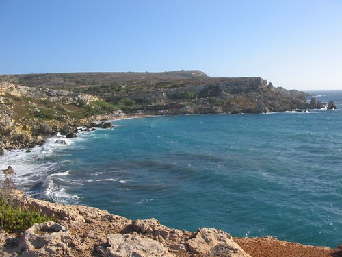
(Photo taken from Ramon Baile on flickr)

Thursday, January 5, 2012

Winter Projects Update

The first project I worked on was researching options for salinity and temperature sensors that we could connect to our robot. I ended up writing a report that can be briefly summarized as follows:

The most used tool to collect salinity and temperature data with a VideoRay ROV is the YSI Sonde with Multiple Water Sensors. The main problems were that it was too large and too expensive. Another option was to build the sensors. I found freely available circuit diagrams for these sensors and looking at the parts they would require, building them would cost very little. The problem with this option was that whatever we make would not be guaranteed to work in our application and environment.

After the team read the report, it was agreed that the YSI Sonde with Multiple Water Sensors was too expensive and we would most likely need to build all our sensors. Fortunate for us, during the break Dr. Clark was contacted by an employee of the company that makes our ROV and was offered a temperature sensor. Currently the team is working on connecting our sensors to a microcontroller to better organize the collection of data.

The second project I worked on was the Google Earth project. This project is about displaying the cultural and scientific data, that we will be collecting in Malta and Sicily, in a way that is useful for archaeologist, marine biologists, teachers and students. I was specifically working on evaluating the application, Google Earth, as a practical way to disseminate our information. My findings supported the use of Google Earth as a way to connect geographical and location based data with the database of our scientific and cultural data. I also built an example web page connecting Google Earth with some of our older data that can be seen below.

Thursday, December 29, 2011

Goals for the Program

Earl Nightingale once said that "People with goals succeed because they know where they're going." It is only fitting that each of us have goals for the ICEX project and our trip to Malta. I have a main goal and two learning goals.

My main goal is related to the project I am assigned to lead. I am in charge of acquiring, analyzing and displaying the marine data (salinity and temperature) for local marine biologists. My main goal is to accomplish this in a way that the result is helpful to the research of the marine biologists.

Of my learning goals, one is technical and one is cultural. My technical goal is to leave the program with real world experience in graphics programing, interface design, application and analysis of algorithms, and autonomous robotics. My cultural goal is to leave Malta with a better understanding of the culture and people so that I feel it has impacted the way I think and look at the world.

Friday, November 11, 2011

Brent's Bio


Hi everyone,

My name is Brent Williams I am a third year computer science major. I have been programming for a little over 4 years now . My passions are technology and art. In my free time I love to play beach volleyball and create traditional and digital art. I plan to get a master's degree in computer science and work in the field of computer graphics. When not in school I can usually be found in my home town of San Ramon, California. I cannot begin to express how excited I am to be a part of this team!