Monday, January 30, 2012

Ethnic Studies Paper

For our Ethnics Studies class this quarter, we were required to write about the papers read in class and our overall impressions of what we had just learned about engineering and society and their impacts on each other. Following is my Response Paper for this assignment:

One of the first things I thought of when reading these sources was how cultures have changed over time and how people’s loyalty to tradition has altered. Yet, even though cultures are constantly changing, we have a stereotypical view of how certain cultures are. For example, if I were asked to picture a Japanese family, the first scene I would think of is a big family sitting in an Asian style home with a small garden and pond and all the family members wearing kimonos and socks with sandals and eating sushi. Now I know that this is not the typical outfit of modern day Japanese people, however it is the image that I’ve always thought of first when thinking about Japanese culture.

I began thinking about how cultures have changed over time and why they do. I remembered a story my grandmother told me about her grandmother. Her grandmother was born and raised in Germany and came over to the United States. Once, during World War II, she went to the grocery store, my grandmother was with her. Two women became very cold and mean towards them both, because of her grandmother’s German accent, even going to the point of spitting on her.

When I talked about this with my grandmother, she said that there were many families who came over to the United States and tried to erase all traces of their previous cultures, in order to fit in, especially during wars. My grandmother remembers, that none of her mother’s family members were allowed to speak German anywhere while they lived in the United States, even going to the point that the children were not fully allowed to learn the language. Due to the fear of not assimilating into American culture, my family lost the part of its history and culture that came from Germany when my great-great-grandparents immigrated.

Lucena states in his article, “Culture as Dominant Images,” on page 1, “Dominant images create expectations about how individuals in that location are supposed to act or behave.” In my family’s case, in order to become more “American,” they tried to erase all the dominant images that were connected to the country they were born in.

De Courtivron’s article, “Educating the Global Student, Whose Identity is Always a Matter of Choice,” page 1, states “Today, young urbanized American men and women of 20 … are likely to have more in common with young Japanese men from Tokyo or young Turkish women from Istanbul than with their own grandparents.” Traditions aren’t being passed down as much anymore. There are less and less people that are embracing the cultures of their parents and grandparents. I believe this is mainly due to a changing world. With new technology, new ideas, and new concerns, the dominant images that were so central previously now hold little say in the current world. “The weight of the world used to be vertical; it used to come from the past, or from the hierarchy of heaven and earth and hell; now it is horizontal, made up of the endless multiplicity of events going on at once and pressing at each moment on our minds and our living rooms.” (De Courtivron, page 1)

This quote makes me visualize a line connecting many different people. In the past, the line was vertical with newer generations at the bottom and looking up to the generations of the past and seeing how they lived and worked. Now, I imagine the line horizontal, with people looking to their left and right, seeing what their neighbors are doing and not considering how their ancestors lived as much. This change in the “connection of people” is the changing of cultures and shifting of lifestyles.

In Hiller’s article, “Understanding Culture: The Discovery of the YEKOH Ritual,” page 228, he describes the SNAIDANAC people’s “ritual ironically creates divisions within the society at the same time that it provides the basis for general society identity and cohesion.” This tells me that these people realize that their ritual and culture is what makes them unique and a special race; however, it is also clashing with different ideas that coincide with a planet that is changing, evolving and moving forward.

I think culture is an interesting way of looking into people’s lives and their history. It makes me wonder how the changing of technology and people’s connections, will change the cultures people have. Culture, to me, is what makes a group of people unique from another group. But as the world moves forward and people become more global, meeting new people, ideas, and traditions, what will happen to independent cultures?

Projective Texturing


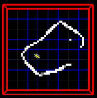
I spent some time this last week getting started with the new projective texturing system. Here is what the current system looks like:


In order to improve this system, two main changes will be made. The first is to perform a histogram equalization on all input pictures, bringing the regions of the cistern to a more uniform brightness and contrast. The second step will be to wait the projections closest to the camera higher than the projections further from the camera. This will cause the camera to view a cistern more consistent with the source photographs from the c
amera's location.

So far, histogram equalization does a good job of equalizing the image, but it really emphasizes the backscatter in the water. I will need to perform a smoothing pass on the images in order to remove this effect.


Robots at Pacheco!


This last Wednesday we had the opportunity to visit the kids at Pacheco elementary once again. We came armed with a bucket of neat solar robot kits that teams of students would get the opportunity to play with. Kids could chose from a number of models, such as a race car, windmill, airboat, or walking dog.

We started out by reviewing the basics from last week and then went over the different sources of power for an electric motor. We gave a quick explanation of how electric motors work, then set the kids loose to build their robots.

My group built the airboat and had a ton of fun using the lamps we brought to drive it around the sink. A few other groups built the walking dog, race car, and boat as well. The kids were having a blast watching their robots cruise around the room!

After everyone had successfully built a working model, we had the kids tear everything down and then build a race car for each group. Once everyone had finished, we took all of the cars outside in the sun and raced them down the sidewalk. The kids absolutely loved this part, and I had a pretty good time myself. It was really funny to watch them all running down the road screaming at their cars to go faster.

Afterwards, we packed everything up and headed out, another successful lesson completed! This coming week we'll be doing the same lesson with a different group of kids. Looking forward to it!

Sunday, January 29, 2012

Cultural Update

So as mentioned last week, we all (the Cal Poly folks) are studying Malta in an Ethnic Studies class here at Cal Poly. This past week the class broke up into groups and focused on different eras of Malta and then presented our findings to the class. I'm going to attempt to highlight some of the information we talked about. (Feel free to comment on this post to add more information).

Over the years, Malta has been ruled by many different countries starting all the way back in 5200 BC where the first settlers arrived in Malta. These settlers are thought to have arrived by boat from Sicily and where hunters and farmers. The Greeks, Phoenicians, and Romans fought over Malta up until the Middle Ages. At that point it was given to the Knights of Malta around 1530 by Emperor Charles V. Some time before Britain took over in 1814, Napoleon even ruled the island. Britain had control over the island up until Malta's independence in 1964.

As far as education goes in Malta, Britain had a large impact. The university's educational system is a mixture of British and French principles as far as working hands on versus theoretical. This combination varied over time. In the 70s, the University of Malta actually shutdown to allow for growth of vocational schools. In the early years of Malta's development as a young nation, education was so highly coveted that all expenses were paid for students from kindergarten through undergraduate. Undergraduate fees have since been applied according to the needs of the economy.

Other topics discussed involved Malta's lack of water and demographics like religion, languages, and population.

SLAM Project Update

Well it has been a while since I was suppose to post this, but that just means I'll have better results. So I've been working on optimizing the SLAM code to generate better maps and also increasing the likelihood of the particles converging for a given set of sonar scans. I started by focusing on filtering the sonar data to optimize the overlap between scans.


Filtering Algorithm


By filtering the data, I can use more of the data already present in the sonar scan to help increase the likelihood of the particles converging.

My next focus will be on refining the filtering algorithm to output cleaner sonar measurements. I also need to work on the scan matching algorithm to load in the first scan at an ideal location where edges won't be cut off. This occurs when the size of the occupancy grid is small and the first scan is loaded in the middle of the map. I'm also waiting for the ROV motor to come in the mail so that I can fix the ROV and then be able to map the pool at the LAIR. This will give us truth data to calculate the error in our algorithm.

Scientific Data Acquisition and Modeling Project Update

As I have said in a previous post, I am in charge of acquiring, analyzing and displaying salinity and temperature data for the marine biologists. I will be using scattered data interpolation to analyze and display our salinity and temperature readings.

So what is scattered data interpolation? It has to do with the idea that we can only take so many measurements. There are going to be places in the cisterns and caves that we didn't collect data, but we still want to have an idea of what the readings would be. So how do we do that? We use math to estimate the data based on the measurements that we collected around them. With this system we can have good estimates for any location in the sites we visit without having to spend too much time taking measurements.

There are really two parts to my project: the acquisition of the data, and the analysis/modeling of the data. What work have I done on them?


For the acquisition of the data, I have been working on getting the salinity and temperature sensors. The salinity sensor me and Tyler are going to build in the next week. We bought two sets of parts for the possibility that one might break. This is mainly due to the fact that previous ICEX members have instilled in me the saying "Always have backups." As for the temperature sensor, we are lucky enough to be getting two for free. Dr. Clark was contacted by an employee of VideoRay (the company who makes our robots) who had an interest in our project. He offered to give us two free MS5541-30C Miniature 30 bar Modules (pressure sensors that also transmit temperature readings) along with two free Protocol Adapter Multiplexers (or PAMs). PAMs are basically small computers that are made to take in data from sensors and send that data up the tether to our computers. Our goal is to be able to press a button on the surface and use PAM to take both salinity and temperature readings, and send it up the tether in one packet.


For the the analysis/modeling part of the project I have been working on visualization software. So far I have gotten one of our old cistern mesh files from Jeff, loaded it into the program, displayed the cistern
and added camera controls allowing you to move around the cistern.

To the left you can see a current picture of my program. It isn't as visually appealing as I would like it to be because I have not yet learned enough about lighting to add it into the program but within another week I should be able to add this feature. Also, I have recently received the code for a previous masters students data visualization project. I am currently
analyzing it in hopes to use parts to do the calculations for the scattered data interpolation.

Saturday, January 28, 2012

Archaeologist Graphic Interface Update

After a meeting this week, we've decided on the applications that will be used for the 3D graphic interface project. Because Google Earth already has a geo-spacially oriented, properly scaled, navigable world built out of satellite images, we decided that it would be best to create a Google Earth layer with links to SONAR mosaics and 3D meshes for each site. This allows us to build the framework for our interface before the trip, and then fill the information from each site right after it is visited.

We plan to embed our Google Earth layer right into Sara's water and society website, and host all of our other files (3D cistern meshes, SONAR overlays, etc.) there as well. The embedded Google Earth layer will have pop up descriptions, pictures, and links to other information collected from each cistern. I will still be using an embedded Unity3D frame to display the 3D cistern meshes (slightly simpler than writing code in WebGL that would allow the 3D mesh file to be navigable by a camera, although it does require a browser plug-in unlike WebGL). This frame will also be hosted on the Omeka water and society website. I should have a samples up shortly! Stay tuned!

Friday, January 27, 2012

3D Bump-Mapping Update:

Currently most of my work is going into creating software that will generate 3D maps from our two GoPro cameras. Following this work, I will focus on bump-map texturing using those 3D maps.

We decided to use two GoPro Hero2s for this project. These will be connected in parallel to provide synced stereo images-which can be used to create depth maps of cistern walls.

The cameras arrived a few weeks ago, but after testing them in the pool I found that they could not provide focused underwater images. The problem was that the GoPro enclosure uses a fish-eye lens to provide the maximum possible viewing angle. Based on internet research, I decided to buy a set of replacement lenses for the Go-Pro housing. I installed the new lenses earlier this week and tested the enclosure in the bathtub. I didn't detect any leaks in the enclosure and the images I took were in much better focus. However, the enclosure still needs to be tested in a deep pool before I will be confident in the fix.

I am currently working on the software to calibrate and collect data from the cameras. I have had some trouble with the new OpenCV 2 libraries, so I will be using the old c-style OpenCV functions and types instead. As of Wednesday, my software was able to recognize the calibration points on a chessboard. By the end of this weekend I hope to have something much more impressive. Full steam ahead!

Saturday, January 21, 2012

Introduction to Malta


All of the ICEX students from Cal Poly are taking an Ethnic Studies class, taught by Dr. Jane Lehr, called Global Engineering. It is a "comparative examination of historical and contemporary engineering institutions in different national contexts" in which Malta is a major case study. Just recently we started reading about Malta. In class we started to discuss what we believe were some of the major people, ideas and events that affected Malta throughout it's history. Some of what we discussed can be found below.


For all of you who don't know, Malta is a small country made up of 3 islands located South of Sicily and East of Tunisia. It has an area of 316 square kilometers which is about 2.5 times the size of San Francisco. With such a small area and a population of approximately 408,000 people, it is the country with the highest population density in Europe and one of the countries with highest population densities in the world. Of the 408,000 people, 98% are Roman Catholic. Malta has two national languages, Maltese and English. The Maltese language is Semitic (meaning that it descended from Arabic) but also has Italian influences.


Malta has very little freshwater and gets more than half of its drinking water from desalination. It's economy is based heavily on trade. Its location in the Mediterranean Sea makes it a prime transshipment point. This fact has been realized by many groups throughout history making Malta consistently a spot for military contention. It has been attacked or ruled by the Arabs, the Normans, the Knights of Saint John, Napoleon, and Great Britain, among others. Malta won its independence in 1964, joined the European Union in 2004 and in 2008 adopted the Euro .

(Photo taken from Ramon Baile on flickr)

IRB Forms, Omeka and Water and Society Project

The Water and Society Project, I am working on is mainly targeted at educators and classrooms that are interested in learning more about water and its impact on Malta and its culture. Envisioned for this project is to be able to set up curriculums and lesson plans based around gathering information from sources and references that ICEX has collect throughout its research on Malta.

This past week and a half, I have been working with Jane to fill out and submit IRB forms for my part of the project. For my project, specifically, we needed to gather information about the cisterns and interview people who came into contact with them. However, to be able to interview individuals and use the information we receive from them we needed to submit three forms to the Human Research Committee, who would determine whether the research we are doing will not harm any of the individuals we come into contact with and that the research is acceptable. We spent quite a bit of time, writing, revising and changing the forms to describe all aspects of the project. I submitted the forms this morning, so we are hoping the Committee will review our documents and approve our project soon, before we leave we hope!

Jane, Erik, Brent, and I also decided that Omeka was going to be our UI & database. It will hold all of the sources and information we collect. Zoe introduced Jane, Erik and I to Alan in the Computer Science Department and we discussed with him the possibility of us using Cal Poly server space to hold the Omeka information. We decided that was probably the best for this project, however, Alan said that usually projects that use the Cal Poly server space are not permanent and thus get little bits of space. We don't think that the project will use a lot of space, so we think this will be alright for the time being at least. Once we get to the point where we need more space or want to change the duration of the project, etc. we will decide the next step then.

Lastly! The four of us also had a skype session with John Lester about unity 3D and Jibe products and their abilities and limitations. I think we will use this for Erik's project, specifically for the archeologist side, however, Jane and I have bounced around the idea of using it in collaboration with Omeka for the Water and Society Project as well. We haven't figured out all the details yet, but from my knowledge it would be really cool to use.

The program is a virtual world program, which enables a person to create a character and walk around and interact with a world that we (the ICEX members) can build. Characters can come into contact with each other, have meetings, presentations, look at specific locations, and do a bunch of other things that can make it more user friendly to get information about Malta and its cisterns.

The part that Jane and I were most interested in for the Water and Society Project, was the ability to hold tours or classroom 'field trips' to the various locations in Malta with the information that we will collect once over there. I think this would be a great tool for educators to be able to use and I would love to try and work with it for the project, but due to the cost and some other factors, we haven't decided yet whether we will officially try to use it yet or not.

That's the most of it so far! I will be working more with Omeka and looking at unity 3D and Jibe in more detail in the near future and we will be waiting anxiously from the Human Research Committee to see if our study has been approved and we can move forward!

Friday, January 20, 2012

ROV Driving, Localizing, and Data Collection

The 2012 Cal Poly ICEX Team

Dr. Clark visited us from Princeton over the weekend and we had an opportunity to hit the pool and play with the ROV! I have to admit, I was pretty surprised by how small it is; certainly beneficial for navigating the cisterns! We went through everything involved in preparing the robot, setting up a work site, and driving around underwater.

We had some difficulties connecting the sonar module, as the Serial - USB converter buffered data and disrupted the data stream. After a bit of fiddling with the sensor and connections, we found a laptop that still had a RS-232 port built in. This eliminated the buffer problem and was able to give us full sonar data.

Each member of the group took turns navigating the Poly Canyon swimming pool with our backs turned, using only the control box. This was a pretty good simulation of what it will be like to operate the 'bot in a cistern environment. After everyone was familiar with the basic controls, we threw some dive toys in the water and practiced retrieving our 'artifacts' with the robot gripper. It was quite a challenge!

Unfortunately, one of the drive motors had suffered water damage at some time in the past. After a few hours of running, the motor failed and bound up, cutting our session short. It took us sometime to trace the problem down to the motor, but when we finally pulled it out it was unmistakably caked with salt corrosion. We'll have to wait a little while to receive a replacement, but at least we all got a chance to see and drive the 'bot!

As part of our weekly lab meetings, so far we have heard from Billy and Jeff. Billy gave a presentation on the workings of FastSLAM and how the robot localizes itself while mapping out a cistern. In addition, Jeff gave a presentation on how this mapping data is processed to remove holes and create a traditional .m mesh file describing the geometry of the cistern. From here, I will take the mesh file and perform projective texturing onto the surfaces using the pictures gathered from the ROV. Now that we have an understanding of localization and mesh generation, Dr. Wood, Billy, Jeff, Tim, and I will be meeting sometime in the next few days to discuss the algorithms we intend to use to perform the texturing and bump mapping of the cistern.

Thursday, January 19, 2012

Pacheco Elementary Labs and 3D Visualization Update

Hi everyone,

Today was our second of 6 robotics demos for the kids at Pacheco, and things went great! We have done lab #1 both weeks for different classes so far, and the kids love it. The lesson goes something like this:

We show up, the kids come in from recess, and Mrs. Banfield introduces us to them and tells them that we are there to talk about robotics, at which point every kid in the class gasps "OHHHHHHH ROBOTS!!!".

From there I start off with a powerpoint that shows Wall-E bumbling around on the screen collecting balls, and we split up into groups to talk with students about what the know and what they would like to learn about robots. I walk back to the front to ask them questions about better known robots like Roombas, and then Billy gets up to talk about one of the robots that was sitting around in the LAIR. After Billy talks about the brains, arms, and eyes of that robot, we split up into groups again to let the kids design a robot of their own on paper.

After that the fun begins. Tyler and Sara have a competition to see who can build a Lego robot the fastest, and then we ask the kids what they think these robots do. We tell them that the robots brains were programmed to follow lines, so when you lay white masking tape on the black carpet, the robots know how to stay on track. We then demonstrate by allowing each kid to lay down a piece of tape so that a track is made. We put the lego robots on the track and the kids watch as the robots follow the lines (and sometimes collide with each other). After that, we get back into groups to talk about what they learned today, and then I head back up to the front to introduce the solar robots that we will be playing with next time we meet them.

The kids are so enthusiastic about the lesson, and Mrs. Banfield is right there with them. Hopefully we can keep up the great work at Pacheco elementary in the next 4 weeks!


On the 3D visualization front: Jane, Sara, Brent, and I skyped with John "Pathfinder" Lester, who works at ReactionGrid developing 3D environments with which people can model things. He told us about some software (Unity3D and Jibe) with which we can carry out our project for our archaeologist friends. Unity3D is a video game development software that seems to be just what we need. I plan on getting some bigger projects up and running so that in the end, we can have a map of malta with specific sites that can be zoomed into. On clicking a site, a 3D textured version of it will pop up (hopefully with a 3D model of the cistern in it) that will have triggers that bring up descriptions of the area. More from me later!


Thursday, January 12, 2012

Goals and Progress

Over the break I've worked on integrating the data from Smart Tether into the FastSLAM algorithm for better localization of the ROV in the underwater caves of Malta. The algorithm will match up several Smart Tether measurements with the times of the sonar scans and use an average of those measurements to calculate a weight for a given particle's estimated position of the ROV. I've also started to make sample Smart Tether data based on the data we collected at the pool to use for testing.

Having worked on localization with the x80 ground robot and a known map in Prof. Clark's Autonomous Robot Navigation class, I am interested in the technical challenges presented by underwater localization and with having no map initially. I've studied Latin for four years and Italian for two, so I'm very interested in the history of Malta as it dates back to Greek and Roman times as well as the culture of Malta and the Mediterranean region.

Saturday, January 7, 2012

Learning Objectives

My learning objectives for the ICEX program include learning more about algorithms and programming approaches that will help improve the look and speed of the current visualizations pipeline. As a member of last year’s team, I obtained a basic understanding of graphics and scientific visualizations. This year, I would like to focus on exploring the vast field of computer graphics from a more experienced position. Specifically, I would like to continue my summer’s work on hole filling of sonar data and statistical analysis of the filled walls. My more general goal is to gain more knowledge in the computer graphics field and use my new knowledge to obtain a computer graphics programming internship in the future. Another objective is to share my knowledge and experience from last year with other team members. Last year, I learned about Malta’s culture and I look forward to adding to that knowledge base. This year we will also be working in Sicily, and I am excited to learn and explore a culture I have limited knowledge of.

Winter Progress

As a participant of last year’s ICEX team, I had the opportunity to continue working on our solutions over the summer. Towards the end of the summer, I was working on creating a function to determine confidence values for walls generated by the Hole Filling algorithm. Unfortunately, school started and I no longer had time to work on the solution. Over break, I completed the remaining parts of the algorithm and added confidence values to the input data. I then used these calculated confidence values to add more information to the visualization of the cisterns. Additionally, I tied up loose ends in the existing software to create a more stable and complete graphics pipeline. The existing Hole Filling software was not robust, as it would only run if certain sampling rules were followed. I found and fixed many bugs related to this problem, and the algorithm now runs as expected.

To the left is an image of a cistern mapped by last year’s team with the hole filled (there is no indication of a hole being filled). To the right is an image of the same cistern using transparency to illustrate the calculated confidence value of the filled hole (the confidence values used are a sample).

Winter Break

My winter break was quite busy, but during my spare time I did a little bit of work for ICEX. I am the scheduler for this trip and the program, so over the break I looked into ways to keep on top of it all to make sure all deadlines are met. Tyler gave me a link into a website called Trello and it seems like it's really going to help keep everything organized for me.

Also, I looked into using Google Earth to locate cistern sites. Unfortunately, I don't know much about Google Earth and wasn't able to figure out much. And lastly, I looked into a site called Omeka to use for my ICEX project. It seems like a good site in which to have a digital library and database for information we collect about Malta and its water and society.

This project using Omeka is targeted to be used to be a resource site for teachers and educators. It will (hopefully) have sources and information such that teachers can base lesson plans off of the information and resources on the website.

Robotics in SLO Update

Over break, I sent the ROV we have here at Cal Poly to VideoRay for repairs. Several parts needed to be replaced due to water leaking into the robot's hull. To my knowledge it is still under repair.

As for the software side of robotics, I worked on SLAM. I was able to get the scan matching algorithm working. This algorithm attempts to use SLAM to converge every possible pair of sonar scans of a cistern in order to localize the ROV for each scan's position.

Before we added the "Auto-converge" localization technique, we were manually mosaicking the sonar scans together and then measuring the displacement values between a reference scan and all the other scans. The displacement values for each scan were inputted into the code and used as the initial locations of the ROV when trying to add scans to a map. The code we have now does this mosaicking automatically.

The next step is to figure out how to prevent the particles from converging in the wrong location. I'm writing a paper on the Malta work from last year up till now, which is consuming most of my time.

Here are before and after images of merging two scans. Here I'm just using SLAM to add the second scan.


Using Scan Matching Algorithm w/ just 2 Scans


Friday, January 6, 2012

Winter Break Work:

Over break I implemented a bump map rendering system and researched stereo imaging. Both of these projects will be used to create more realistic, bumpy, cistern walls.

The bump map rendering system combines a surface texture, a bump map, and a mesh of vertices to create the illusion of surface deformations, or depth. The bump map is actually a map of normal vectors for each pixel in the map. The colors of each pixel in the bump map, red, green, and blue, determine the x, y, and z components of the normal vector at that pixel. Given the normal vector of a pixel, the position of a light, and some coordinate transformations, the amount of light that falls on any one pixel can be calculated. A grayscale mask can then be constructed to dim the desired pixels. The mask is then applied on top of the original texture to create the illusion of bumps. The following is a screenshot of a cylinder that has been textured with a yellow and blue checker grid and a bump map.


The renderer uses OpenGL and GLUT. I had never used either of these, so a good portion of my break was dedicated to setting up OpenGL and learning about the graphics pipeline. It was a great learning experience to be sure!

Stereo imaging will be used to create bump maps for the aforementioned renderer. The trick to stereo imaging is to capture two images simultaneously and then compare almost identical features in both images to compute the relative distance of those features using triangulation. I am currently planning on using the OpenCV libraries for camera calibrations and 3D map generation. After discussions, we are planning on mounting two GoPro cameras to the top of the Video Ray−as mentioned below.

ICEX Learning Goals

ICEX presents a fantastic educational opportunity. I am confident that this experience will have more to teach me than I can possibly imagine. However, I am particularly interested in the history of the country itself. Our Ethnic Studies class has a large module on Malta, but it focuses heavily on the engineering component of the country's culture. I hope to learn more about the actual historical development of Malta, from the age of the Greeks all the way through modern day.

My primary task with the team is the texturing of the sonar geometry model. I am very excited about this project, as it is my first experience with proper image processing and model generation. My main technical goal, therefore, is to greatly expand my understanding and expertise with the methods used for image processing via the creation of a robust and dependable texturing algorithm.

Thursday, January 5, 2012

Winter Projects Update

The first project I worked on was researching options for salinity and temperature sensors that we could connect to our robot. I ended up writing a report that can be briefly summarized as follows:

The most used tool to collect salinity and temperature data with a VideoRay ROV is the YSI Sonde with Multiple Water Sensors. The main problems were that it was too large and too expensive. Another option was to build the sensors. I found freely available circuit diagrams for these sensors and looking at the parts they would require, building them would cost very little. The problem with this option was that whatever we make would not be guaranteed to work in our application and environment.

After the team read the report, it was agreed that the YSI Sonde with Multiple Water Sensors was too expensive and we would most likely need to build all our sensors. Fortunate for us, during the break Dr. Clark was contacted by an employee of the company that makes our ROV and was offered a temperature sensor. Currently the team is working on connecting our sensors to a microcontroller to better organize the collection of data.

The second project I worked on was the Google Earth project. This project is about displaying the cultural and scientific data, that we will be collecting in Malta and Sicily, in a way that is useful for archaeologist, marine biologists, teachers and students. I was specifically working on evaluating the application, Google Earth, as a practical way to disseminate our information. My findings supported the use of Google Earth as a way to connect geographical and location based data with the database of our scientific and cultural data. I also built an example web page connecting Google Earth with some of our older data that can be seen below.

Monday, January 2, 2012

Winter Break Update

Happy New Year everyone!

Before break, the Princeton team met up at swimming pool to get some data to work with over break up until our trip to Malta. I've been working on making use of that data. We took both vertical and horizontal scans of one end of the pool in an atempt to simulate the environment of the Maltese cave. The idea is to use horizontal scans (along with data from the smart tether we'll be getting; Drew is working on that) to connect the vertical scans. Then, the walls of the cave are "grown" outward from the vertical scans to give a full 3D map of the cave.

I'm a huge history buff, so I've been looking into Maltese history, both ancient and recent. For most of it's history, Malta has been ruled by a foreign power (Greece, Britan, France, and others). They only recently got their independence in 1964. Of course there is only so much you can learn from reading, so I'm looking foward to getting the opportunity to actually talk with some locals about their contry's history. I'm also interested to see what the Maltese perspective is on some of the recent events in the news.

Winter Break Progress

Over winter break I had two tasks. The first task was to do some investigation into Google Earth's ability to display our findings. The second was to get everything prepared for our labs at Pacheco. The progress I made towards these two projects is summarized below:

Google Earth
I'm convinced that Google Earth will be a sufficient tool for sharing our results. It has every feature that we need: html formatting, easy to link to files from databases, image/video embedding, descriptions of each site, underground depth/maps. Additionally, it is commonly used software, making it easier to spread our findings.

That said, there are a few things that I haven't figured out yet. I don't know how to share a google earth file so that multiple people can edit it at once (aside from e-mailing the other person the file). I think the program has this capability, but I haven't figured out how it works yet. Another problem is that when you create a map of a place below ground (cisterns are below ground) the polygon won't show up on a map embedded into a website. The last problem is that I can get an embedded video to work on MY copy of google earth, but can't get an embedded video working in an embedded blog post like this one. Anyways, problems aside, here is a little sample that I made up.


If you have the Google Earth plugin installed, you should be able to view this. The camera should pan to my house and you will see some information about it when you click it. If you double click "Erik's house", it will zoom in to street view. Additionally, you may click the green polygon on the ground to see an outline of my underground lab, and again, some information on that. As far as I can tell, this is what we need for the project.


Pacheco Labs
I received a copy of the powerpoints and lecture notes from last year, and have been discussing everything with Chris, Jane, and the teacher from Pacheco (Jill). Looks like we're all going to meet up as a group on Wednesday at 12:10 to talk about the curriculum and maybe do a run through of the first demo that we will do for Jill's class on week 2. The first demo is a discussion of robotics, engineering, and then a demo of a line follower robot.

Over break I borrowed a Lego Minstorms kit from professor John Chen to make a line following robot. I got him working, but just barely. I was testing him out on brown cardboard with black electrical tape and poor lighting, and Jill's classroom is black/grey carpet so we will need to use masking tape. I will be going to her classroom on Wednesday afternoon to test out this one. The bots that we will be using for the week 4 & 5 demos will be borrowed from Jill, and the bots for the week 6 & 7 demos are in the LAIR, but need some repairing. I'll get to that in a week or two. That just about wraps everything up for now. More from me later!

Oh, and here are a few bad photos of the bot that I made for the first lab.